Remote-controlled research. The research boat completed a mission during which it mapped the bottom of the Atlantic
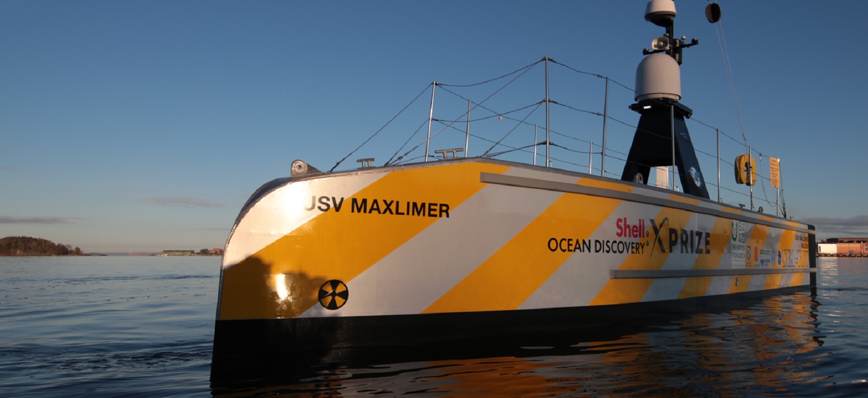
The British Maxlimer has just proven that the future of ocean and sea exploration may lie in remote-controlled boats.
The Uncrewed Surface Vessel (USV) Maxlimer has just completed its 22-day mission to map the ocean floor in the Atlantic.
Throughout the mission, SEA-KIT , the company that built the ship, navigated it by satellite from its headquarters in Tollesbury, East England. SEA-KIT representatives believe that remote-controlled boats will dramatically change the way people work at sea. This is evident in the emerging trend in which large research companies using traditional manned boats are starting to invest in new remote-controlled technologies. A similar trend is visible among freight operators who see the potential for significant savings in remote-controlled boats.

Before that, however, controlling ships and boats from shore must prove to be a practical and safe option. This is precisely why Maxlimer was created.
The ship left Plymouth, UK in late July. The destination was 460 km southwest of Plymouth.
With the help of an echo sounder attached to the hull, the boat mapped over 1000 square kilometers of the continental shelf to a depth of approx. 1 km. It is worth noting, however, that the original goals were much more ambitious. SEA-KIT was to be shipped across the Atlantic to the United States, but the coronavirus pandemic prevented such a mission from being carried out.
The primary goal of the mission was to demonstrate the possibility of exploring as yet unexplored parts of the ocean using current technologies. Despite COVID-19 obstacles to mission planning, we believe this goal has been achieved. We have proved that we have the ability to remotely control our boat from over the horizon
Said Peter Walker, the company’s director.
The USV Maxlimer project was originally created as part of the Shell Ocean Discovery XPRIZE competition. The competition searched for next-generation technologies that would be useful for mapping the global ocean floor. So far, humans have mapped just one fifth of the ocean floor. If we want to hope to fill the gaps in our knowledge, we will have to use unmanned boats.
Maxlimer uses the Global Situational Awareness via Internet system for communication and control. This system allows the operator to remotely access images from the camera system, radar and infrared cameras. In addition, the operator is listening to the vicinity of the USV and can send voice messages to nearby ships.
During the mission, Maxlimer connects to three independent satellite systems to stay in constant contact with the control center in Tollesbury.
The boat itself is moving slowly, at speeds of up to four knots, but its hybrid propulsion is very efficient.
We were not sure how much fuel would be left in our tanks after the mission. We expected it to be around 300-400 liters. It turned out that there are still 1,300 liters on board, or a third of the tank
– says Ben Simpson, CEO and designer at SEA-KIT.
Although these are only the first steps, the future of robotic, unmanned research ships seems to be rosy thanks to Maxlimer. This is very good news. It would be stupid if we went to explore Mars without knowing even our own planet.
Don’t miss out on new texts. Follow Spider’s Web on Google News .
Remote-controlled research. The research boat completed a mission during which it mapped the bottom of the Atlantic

from WordPress https://ift.tt/3g4wJ2g


Comments
Post a Comment